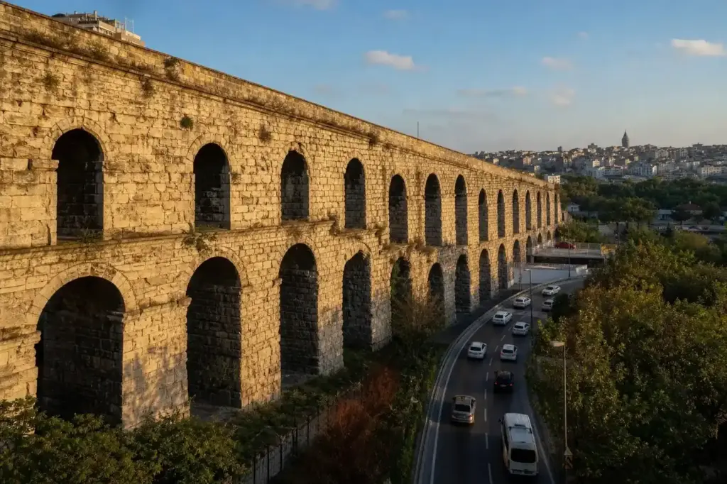
The Valens Aqueduct, known locally as Bozdoğan Kemeri, stands as one of Istanbul’s most impressive Roman-era structures. Completed in 373 CE by Emperor Valens, it forms the visible terminus of a vast imperial water system that once stretched hundreds of kilometers from mountain springs to Constantinople’s cisterns and fountains.
Unlike many historical monuments set apart in museums or archaeological parks, the Valens Aqueduct has been woven directly into modern urban life. The busy Atatürk Boulevard passes through its arches, cars drive beneath its stone spans daily, and tea drinkers gather in its shadow. This integration into the city’s fabric makes it a unique bridge between ancient and contemporary Istanbul.
Quick Facts
| Built / opened | 373 |
|---|---|
| Address | Kalenderhane, Fatih, Istanbul, Turkey Google MapsApple MapsYandex Maps |
| District | Fatih |
| Metro | Vezneciler (M2, 10 minutes walk) |
| Admission | Free |
| Best time to visit | Any time of day; morning light (before 10 AM) and late afternoon (after 4 PM) provide clearer shadows and definition of the stonework for photography. Avoid midday harsh sun if you want softer images. The site is less crowded early in the morning or on weekday afternoons. Winter and early spring offer clearer air in Istanbul; summer can be hazy. The aqueduct is equally interesting in all seasons and weather. |
What Is (and Isn't) Part of a Visit to Valens Aqueduct?
| Part | Status | Notes |
|---|---|---|
| The standing aqueduct structure under Atatürk Boulevard | Included in the standard ticket | The visible 921-meter section is free to walk beneath and around. |
| The broader water system (underground channels, distant spring sources) | Outside / not part of it | Most of the aqueduct's original 268+ kilometer extent is underground or no longer exists; only this visible urban section remains accessible. |
| Yerebatan Cistern, Basilica Cistern, other cisterns | Separate ticket or institution | Water from the aqueduct filled these cisterns, but they are separate sites with their own admission fees and hours. |
| Topkapı Palace | Separate ticket or institution | The aqueduct once supplied the palace, but they are separate attractions requiring separate tickets. |
| Fatih Mosque | Outside / not part of it | Located on the hill the aqueduct spans, but not part of a visit to the aqueduct itself. |
| Suleymaniye Mosque | Outside / not part of it | Nearby but not part of the aqueduct site; reachable on foot in under 15 minutes. |
Why Visit Valens Aqueduct?
The aqueduct offers a rare chance to stand directly beneath Roman engineering on an unprecedented scale. At 29 meters high and stretching 971 meters across a valley, it demonstrates the technological prowess that sustained a metropolis of hundreds of thousands. The structure combines practical water transport with monumental design—two tiers of arches in some sections showcase both engineering precision and architectural ambition. The site is free to visit and walkable from the Grand Bazaar, making it accessible to all travelers interested in the city’s layer of Roman heritage beneath Ottoman and modern Istanbul.
Highlights of Valens Aqueduct
The Stone Arches
Walk directly beneath the surviving section to appreciate the scale and craftsmanship. The arches are built from stone and brick, with some sections featuring two tiers stacked vertically. The surviving 921 meters preserve the original Roman construction from the 4th century, though later emperors and Ottoman sultans added or rebuilt sections over time. Look for the transition between single and double-tiered arches as you move along the structure.
Tip: The best vantage point is from ground level directly under the arches, where the perspective emphasizes the engineering feat. Late afternoon light picks out the stone work clearly.
Atatürk Boulevard Passage
One of the most striking features is how modern Istanbul has built directly through the ancient structure. Atatürk Boulevard, the city's main north-south artery and one of the busiest roads, runs through the aqueduct's arches. Cars, buses, and motorcycles pass beneath Roman stonework daily—a visceral reminder that this is not a preserved ruin behind gates, but a living part of the city's infrastructure.
Tip: Stand on the pavement to watch traffic flow through the arches. The contrast between ancient and modern transport is striking and makes for compelling photographs.
The Water System Behind It
The visible aqueduct is only the urban showcase of a much larger system. In the 4th century, channels stretched 268 kilometers from springs at Danımandere and Pınarca, meeting at Dağyenice before reaching Constantinople. A second system added in the 5th century brought water 120 kilometers from Vize. Water flowed by gravity through underground conduits and surface channels, supplying cisterns like Yerebatan and Binbirdirek, which then distributed it throughout the city.
Tip: Read about the full system before visiting to understand that what you see is the final, most visible segment of an empire-spanning infrastructure project.
Byzantine and Ottoman Repairs
The structure you see today represents work from three empires. Arches 1-40 and 46-51 date to Valens' original 373 CE completion. The Ottomans extensively repaired and expanded the aqueduct in the 16th century under Suleiman the Magnificent, with the imperial architect Sinan overseeing upgrades. Some arches were rebuilt with ogival (pointed) designs, and additional lines were added from the Belgrade Forest to increase capacity.
Tip: Different arch styles visible along the length reveal different construction periods. The double-tiered sections are mostly from the Roman era; the pointed arches are Ottoman-era repairs.
The Bridge Between Hills
The aqueduct spans the valley between Constantinople's third and fourth hills. Originally, the Church of the Holy Apostles stood on the fourth hill (now occupied by the Fatih Mosque); the Capitolium was on the third. The structure's 29-meter height and two-tiered arch design in sections were engineered to carry water across this terrain while maintaining a constant downhill slope of 1 in 1,000—barely perceptible but sufficient for gravity flow over vast distances.
Tip: Look north and south along the valley from the aqueduct's base to visualize the topography it was designed to cross.
The Chalcedon Stone Connection
Tradition holds that the aqueduct was built using stones salvaged from the walls of Chalcedon, demolished in 366 as punishment for the city's support of the rebel Procopius against Emperor Valens. This recycling of materials was practical but also symbolic—Roman power reasserting itself through reuse of a rival city's fortifications. The limestone blocks remain visible in the structure today.
Tip: The aqueduct is located 15 kilometers from the Mâzul Kemer aqueduct, another of Istanbul's surviving Roman water systems, if you want to compare engineering styles.
Atmosphere
Standing beneath the Valens Aqueduct is an experience of collision between eras. Above, modern Istanbul—Atatürk Boulevard’s constant traffic, shops and tea gardens in the surrounding streets, the rhythm of the city going about its day. Below, the weight of nearly 1,650 years of stonework creates a sense of historical continuity. In quiet moments early morning or late afternoon, when traffic eases, the sound changes and the monument’s scale becomes more apparent.
The area around the aqueduct is lived-in and unpretentious. Local tea gardens cluster nearby; the Vefa Bozacisi chickpea drink shop is minutes away; food stalls and small restaurants serve the neighborhood. The aqueduct is not cordoned off as a museum piece but accepted as part of the landscape, walked past by residents heading to work, used as a landmark by locals giving directions. This casualness is part of its charm—a reminder that Istanbul’s history is not confined to guidebooks or special visiting hours.
History of Valens Aqueduct
Water was Constantinople’s founding challenge. The Greek settlement of Byzantium had strategic advantages—a natural harbor, a defensible location—but surrounded by salt water with no river flowing into the city. When Constantine refounded the city as Constantinople in 330 CE, it inherited this chronic water shortage. Early attempts to solve it failed repeatedly.
Construction of the aqueduct system began under Emperor Constantius II (337-361 CE) but progressed slowly. The visible structure was completed in 373 CE under Emperor Valens (364-378 CE), whose name it bears. The inaugural ceremony was performed by the urban prefect Clearchus in that year. The first phase of the system stretched 268 kilometers from springs at Danımandere and Pınarca, converging at Dağyenice before reaching Constantinople.
The aqueduct immediately transformed the city’s viability. Water flowed by gravity through a constant downhill slope into the city’s network of vast cisterns—Yerebatan, Binbirdirek, Aetius, Aspar, and Philoxenos—which then fed fountains, public baths, and private households. By the 5th century, after a severe drought in 382 CE, Emperor Theodosius I expanded the system by adding a second aqueduct bringing water from even farther away at Vize, 120 kilometers distant, adding another 451 kilometers of channels.
During the Byzantine era, the aqueduct suffered damage in the Avar Siege of 626 CE but was repaired and remained operational. The Ottoman conquest of Constantinople in 1453 did not end the aqueduct’s service. Ottoman sultans, recognizing its value, restored and expanded it. Under Suleiman the Magnificent in the 16th century, the imperial architect Mimar Sinan rebuilt arches 47-51 near the Şehzade Mosque with new ogival designs and added two more water lines from the Belgrade Forest to increase capacity.
The aqueduct supplied the Topkapı Palace and remained in use throughout Ottoman rule. While no longer functioning as a water system—modern underground pipes now serve the city—it survives as Istanbul’s most visible monument to Roman engineering and the city’s 1,600-year commitment to solving its water crisis through technology, ingenuity, and repeated reinvestment across three empires.
Legends and Myths about Valens Aqueduct
The Stones of Chalcedon
Legend – historically unreliable. Local tradition claims the aqueduct's stones came from the walls of Chalcedon, demolished in 366 CE as punishment after the city supported the rebel Procopius against Emperor Valens. Whether or not this is literally true, it reflects a historical fact: Chalcedon's walls were indeed demolished after the rebellion. The idea that Valens' enemies' fortifications became the foundation of his water system has a poetic appeal that persists in Byzantine and Ottoman histories.
The Endless Aqueduct
Legend – historically unreliable. Older Ottoman sources sometimes refer to the aqueduct system as stretching impossibly far—some claim it reached beyond the city's immediate surroundings or that its branches extended to distant provinces. These exaggerations reflect the structure's actual scale: a first-century system 268 kilometers long was genuinely staggering engineering for its time and easily entered popular imagination as a limitless network.
Tickets and Booking for Valens Aqueduct
The Valens Aqueduct is free to visit at any time. There is no ticketing system, no operating hours, and no admission control. The site is an open urban monument; you approach it from street level, walk beneath it, and view it from public thoroughfares.
The structure crosses Atatürk Boulevard, a busy main road. The best access is from the north or south on the boulevard itself or from the narrow streets (Kalenderhane, Serdab Sokak) that run parallel. There are no formal entrances or restricted areas.
No separate arrangement is needed; simply approach the site as you would any outdoor landmark in the city.
Suggested itineraries Valens Aqueduct
30 minutes
Walk beneath the aqueduct from east to west (or vice versa) along Atatürk Boulevard or the parallel streets. Stop to look up at the arch detail and photograph from different angles. Notice the variation in arch styles along the length, which reveals different construction periods.
1 hour
Spend 30 minutes at the aqueduct, then walk 10 minutes south to the Vefa Bozacisis or nearby food stalls for refreshment. Return and explore the surrounding neighborhood, which contains Ottoman mosques, baths, and markets that once drew water from this aqueduct.
2-3 hours
Visit the aqueduct early in your stay, then integrate it into a broader walk of the Fatih district. Walk north to the Suleymaniye Mosque (15 minutes), south toward Beyazit and the Grand Bazaar (20-25 minutes), or east toward the Church of the Holy Apostles/Fatih Mosque (10 minutes). The aqueduct is a logical waypoint on any exploration of the historic peninsula's infrastructure.
How to Get to Valens Aqueduct
By Metro: Take Metro Line M2 to Vezneciler station, then walk 8-10 minutes north on Demirbas Caddesi and east through side streets to reach Atatürk Boulevard and the aqueduct. Alternatively, Çemberlitas station (M1/T1) is also walkable but slightly farther (12-15 minutes).
By Foot: If you are staying in Sultanahmet or visiting the Grand Bazaar, the aqueduct is 10-15 minutes north on foot. From the Bazaar, head north through the surrounding market streets toward Atatürk Boulevard; the aqueduct will become visible as you approach.
Landmarks: The structure crosses Atatürk Boulevard between the Fatih Mosque (to the east) and Istanbul University (to the west). Taxi drivers know it by its Turkish name Bozdoğan Kemeri.
Accessibility
The aqueduct is at street level and surrounded by public pavements and roads. The areas directly beneath the arches are accessible but can be uneven in places. There are no formal pathways, no signage, and no facilities (no restrooms, no seating, no shelter). Wheelchair users and those with limited mobility can view the structure from Atatürk Boulevard and adjacent streets, but cannot move close beneath it without navigating uneven ground. The surrounding area is busy with vehicle traffic; exercise caution when crossing to view the structure from different angles.
Food Nearby
The Vefa neighborhood immediately south of the aqueduct is known for traditional food. Vefa Bozacisi, a famous establishment since 1927, serves the traditional chickpea drink boza just minutes away. Nearby are several small restaurants and kebab shops serving Istanbul's working-class neighborhoods, including establishments noted for buryan (pit-baked lamb). Tea gardens and informal food stalls cluster along Atatürk Boulevard. The Grand Bazaar and surrounding market areas are 15-20 minutes south on foot, with countless café and restaurant options.
What to Bring
Comfortable walking shoes suitable for uneven pavements. If visiting in summer, bring water and a hat or sunscreen, as much of the approach is in direct sunlight on busy roads. A camera is useful for capturing the arch detail and the contrast of traffic passing beneath Roman stonework. The site is outdoors with no shelter; dress for the season.
Best Views and Photo Spots of Valens Aqueduct
Directly beneath the center arches
Looking straight up captures the full height and arch detail against the sky. In late afternoon, the lower sun angle highlights the stone texture. This angle emphasizes the engineering and scale.
Best time: Late afternoon (4-6 PM) when lower angle sun creates shadow and definition on the stonework.
From Atatürk Boulevard looking east or west along the structure
The length of the aqueduct recedes into the distance, showing the consistency of arch repetition and the slight changes in style and construction between sections. The road traffic creates layers in the image.
Best time: Early morning (7-9 AM) when fewer vehicles pass through, for clearer visibility of the structure.
From Kalenderhane street running parallel to the north
Closer view of individual arch detail and the front-facing side of the structure, with less traffic in frame. This angle shows the brick and stone masonry pattern clearly.
Best time: Overcast days or early morning for even light that reveals texture without harsh shadows.
From the elevated area north of the structure (near Istanbul University)
A wider perspective showing the aqueduct spanning the valley, the city context around it, and the full height from a higher vantage point. The double-tiered sections are visible in their full configuration.
Best time: Clear days with good visibility; midday sun from the north provides even lighting on the structure's face.
Photography Rules
Photography is unrestricted. The aqueduct is open to the sky and offers numerous angles from street level, beneath the arches, and from adjacent elevated streets. The busy traffic on Atatürk Boulevard is part of the visual drama—many photographers deliberately capture cars or buses passing through the arches to emphasize the living monument concept. No special permits or restrictions apply.
Family Suitability
The aqueduct is suitable for families with children old enough to walk and navigate busy urban streets. The site has no playground facilities, no interactive elements, and no child-specific features. The main challenge is the surrounding traffic on Atatürk Boulevard—adult supervision is essential. Young children may not grasp the historical significance, but older children (8+) interested in history or engineering often find it compelling. Strollers can navigate the pavements but not the uneven ground directly beneath the arches. The site is outdoors with no shelter or refreshment facilities, so plan accordingly in warm or cold weather.
Istanbul Vibes Tips
- Visit early morning or late afternoon, not for different views but to avoid the peak traffic noise and congestion on Atatürk Boulevard. The structure is more peaceful and easier to appreciate when traffic is lighter.
- Don't rush it to a 5-minute walk-through. Spend time looking up, noticing the different arch styles (single vs. double tier), the materials (stone vs. brick), and the wear patterns. These reveal the structure's complex history across three empires.
- Combine it with a visit to the Vefa neighborhood south of the aqueduct. The streets, tea gardens, and food shops in this area were watered by this aqueduct for over 1,600 years. The context enriches the site.
- Do not attempt to cross Atatürk Boulevard multiple times for photos unless you are very familiar with Istanbul traffic. The road is fast-moving and chaotic. Use a single side or stay on the pavement for safety.
- If you are interested in aqueducts, ask locals or a guide about the Mâzul Kemer aqueduct, about 15 kilometers away. Comparing the two systems gives perspective on Roman water engineering across the city.
- The aqueduct is listed in historical guides but is not heavily promoted by Istanbul tourism. It is not crowded by international tourists but is regularly visited by locals and school groups. This accessibility and lack of touristification is part of its charm.
Explore Nearby Valens Aqueduct
Sights near Valens Aqueduct
 Süleymaniye Mosque – about 700 m away (~11 min walk) · typical visit: 1–2 hours9 min on foot from Vezneciler metro
Main image: AI-generated illustration. It may not show the place exactly as it looks.
 Grand Bazaar – about 1.2 km away (~19 min walk) · typical visit: 2–4 hours4 min on foot from Beyazıt-Kapalıçarşı metro, Open 08:30–19:00, closed Sun
Main image: AI-generated illustration. It may not show the place exactly as it looks.
 Şehzade Mosque – about 250 m away (~4 min walk) · typical visit: 1–1.5 hours4 min on foot from Vezneciler metro
Main image: AI-generated illustration. It may not show the place exactly as it looks.
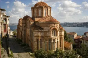 Pantocrator Church – about 450 m away (~7 min walk) · typical visit: 1–2 hours14 min on foot from Vezneciler metro, Open daily 08:00–18:00
Main image: AI-generated illustration. It may not show the place exactly as it looks.
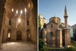 Bodrum Mosque – about 800 m away (~13 min walk) · typical visit: 30–40 minutes6 min on foot from Laleli-Üniversite metro, Open daily 12:00–14:00
Main image: AI-generated illustration. It may not show the place exactly as it looks.
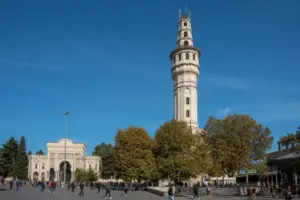 Beyazit Tower – about 850 m away (~14 min walk) · typical visit: 20–30 minutes (viewing from outside)7 min on foot from Vezneciler metro
Main image: AI-generated illustration. It may not show the place exactly as it looks.
Metro stations near Valens Aqueduct
 Vezneciler – about 500 m away (~8 min walk)Open daily 05:59–00:24
Main image: AI-generated illustration. It may not show the place exactly as it looks.
 Laleli-Üniversiteabout 800 m away (~13 min walk)
Main image: AI-generated illustration. It may not show the place exactly as it looks.
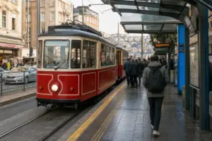 Yusufpaşa – about 1.0 km away (~17 min walk)Open daily 06:00–00:00
Main image: AI-generated illustration. It may not show the place exactly as it looks.
Restaurants and cafes near Valens Aqueduct
 Vefa Bozacısı – about 600 m away (~10 min walk)7 min on foot from Vezneciler metro, Open daily 08:00–00:00
Main image: AI-generated illustration. It may not show the place exactly as it looks.
 Mivan Restaurant – about 350 m away (~6 min walk)4 min on foot from Vezneciler metro, Open daily 08:30–00:00
Main image: AI-generated illustration. It may not show the place exactly as it looks.
 Vodiy Uzbek Restaurant – about 1.2 km away (~19 min walk)7 min on foot from Laleli-Üniversite metro, Open daily 09:00–20:00
Main image: AI-generated illustration. It may not show the place exactly as it looks.
 Pandeli – about 1.3 km away (~21 min walk)12 min on foot from Haliç metro, Open 11:30–19:00, closed Sun
Main image: AI-generated illustration. It may not show the place exactly as it looks.
Train stations and river piers near Valens Aqueduct
 Eminönü Ferry Terminalabout 1.3 km away (~21 min walk)
Main image: AI-generated illustration. It may not show the place exactly as it looks.
 Karaköy Ferry Terminalabout 1.9 km away (~31 min walk)
Main image: AI-generated illustration. It may not show the place exactly as it looks.
Related guides
 Koska Köftecisi: Köfte and Piyaz in Vefa
Main image: AI-generated illustration. It may not show the place exactly as it looks.
 Şerefiye Cistern: A 1,600-Year-Old Byzantine Water Hall with Projection Mapping3 min on foot from Çemberlitaş metro, Open daily 10:00–18:00
Main image: AI-generated illustration. It may not show the place exactly as it looks.
 Zeyrek: Ottoman Neighborhood and Byzantine Mosque Overlooking the Golden Horn
Main image: AI-generated illustration. It may not show the place exactly as it looks.
 Best Underground Cisterns in Istanbul: Three Sites Compared
Main image: AI-generated illustration. It may not show the place exactly as it looks.
 The Red School in Fener: A Castle above the Golden Horn
Main image: AI-generated illustration. It may not show the place exactly as it looks.
Browse more: More in Fatih · All Landmarks · All Sightseeing
FAQ: Valens Aqueduct
Is the Valens Aqueduct the same as the Basilica Cistern?
No. The aqueduct transported water; cisterns stored it underground. The Valens Aqueduct delivered water into cisterns like Yerebatan (Basilica Cistern) and Binbirdirek, which then distributed it. They are separate sites. The aqueduct is free and outdoors; the Basilica Cistern requires a paid ticket and is indoors.
Can you walk inside or under the arches?
Yes. The aqueduct crosses Atatürk Boulevard, and you can walk on the pavements directly beneath the arches from street level. There are no barriers, gates, or restricted areas. You cannot climb on the structure itself.
What is the best way to get there from the Grand Bazaar?
Walk north from the Bazaar through the surrounding market streets toward Atatürk Boulevard—about 10-15 minutes on foot. Alternatively, take Metro Line M1 or M2 to Çemberlitas or Veznecilers station and walk from there (8-12 minutes).
Why does traffic run through the aqueduct?
Atatürk Boulevard, a major north-south road, was built through the city in the 1950s by French architect Henri Prost. It passes through the aqueduct's arches. Rather than demolishing this 1,600-year-old structure, the city adapted and kept it in place. The aqueduct no longer carries water, so this use is practical.
How long should I spend there?
30-45 minutes is realistic to walk the visible section, observe the stonework detail, and take photos. If you combine it with nearby neighborhoods (Vefa, Suleymaniye Mosque area), plan 1-3 hours.
Is there an admission fee?
No. The aqueduct is completely free. It is an open urban monument with no ticketing, no hours restriction, and no facilities.
Who built the aqueduct, and when?
Construction began under Emperor Constantius II (337-361 CE) and was completed in 373 CE by Emperor Valens. Byzantine emperors later expanded it; Ottoman sultans repaired and upgraded it in the 16th century. The structure visible today combines work from all three empires.
Is it safe to visit?
Yes. The area is a normal urban neighborhood frequented by locals and school groups. Exercise standard city awareness regarding personal belongings. The main caution is the traffic on Atatürk Boulevard—stay alert when approaching or crossing the road.
Istanbul Vibes is a one-person project. A coffee keeps it going
Hotels near Valens Aqueduct
- Farina Otel (100 m) Check prices (affiliate link, opens in a new tab)
- Mövenpick Istanbul Old Town (200 m) Check prices (affiliate link, opens in a new tab)
- Hotel Yeşil Park (250 m) Check prices (affiliate link, opens in a new tab)
- Otel Sinan (300 m) Check prices (affiliate link, opens in a new tab)
Affiliate link (opens the booking site): we may earn a commission at no extra cost to you.
Restaurants near Valens Aqueduct
- Göktaş Branda (100 m) Google Maps
- Fatih Sur Börekçisi (100 m) Google Maps
- Bahçıvan 2 Pide Lavaş Fırını (100 m) Google Maps
- Güven Ocakbaşı (150 m) Google Maps
Distances are straight-line, from OpenStreetMap data.

Take this guide with you
Get a free PDF of this guide to print or read offline: key facts, tips and a map link on a few clean pages.
Report an issue on this page
How we research and update our guides
About this guide: AI assistance and accuracy
This guide is created with the help of AI and is based on official sources where available. Mistakes can still happen. Opening hours, prices, rules and other details are given to the best of our knowledge as of the date shown and can change without notice. It offers general recommendations only, not professional, legal or travel advice. Please confirm important details with the official source before you travel; you are responsible for your own plans and decisions.
* Affiliate link: as an Amazon Associate we earn from qualifying purchases at no extra cost to you.